金斯公路车站 (IND卡尔弗线) 車站結構 參考資料 外部連結 导航菜单40°36′11.47″N 73°58′20.44″W / 40.6031861°N 73.9723444°W / 40.6031861; -73.972344440°36′11.47″N 73°58′20.44″W / 40.6031861°N 73.9723444°W / 40.6031861; -73.9723444Station Developers' InformationFacts and Figures: Annual Subway Ridership 2011–2016Feasibility and Analysis of F Express Service in BrooklynFeasibility and Analysis of F Express Service in BrooklynConey Island-bound F subway trains will not stop at Avenue I, Bay Pkwy, Avenue N, Avenue P, Avenue U, and Avenue X until early 2017原始内容New York City Subway Map原始内容$140 Million Culver F subway Line Station Renewal Project Begins Next PhaseBMT Culver Line: Kings HighwayF TrainKings Highway PicturesKings Highway entrance from Google Maps Street ViewAvenue S entrance from Google Maps Street ViewPlatforms from Google Maps Street View (During 2016-2018 Renovation)编
含有英文的條目IND卡爾弗線車站布魯克林紐約地鐵車站1919年启用的铁路车站1919年紐約州建立
紐約地鐵IND卡爾弗線地鐵站布魯克林F線島式月台康尼島
body.skin-minerva .mw-parser-output table.infobox captiontext-align:center
金斯公路 Kings Highway  | |||||||||
|---|---|---|---|---|---|---|---|---|---|
紐約地鐵車站 | |||||||||
 | |||||||||
| 車站統計 | |||||||||
| 地址 | 紐約州紐約市布魯克林金斯公路及麥當奴大道 | ||||||||
| 鎮區 | 布魯克林 | ||||||||
| 位於 | 格雷夫森德、米德伍德 | ||||||||
| 坐標 | 40°36′11.47″N 73°58′20.44″W / 40.6031861°N 73.9723444°W / 40.6031861; -73.9723444坐标:40°36′11.47″N 73°58′20.44″W / 40.6031861°N 73.9723444°W / 40.6031861; -73.9723444 | ||||||||
| 系統 | B系統(IND,前BMT) | ||||||||
| 軌道路線 | IND卡爾弗線 | ||||||||
| 服務路線 | F  (任何時候停站) (任何時候停站) | ||||||||
| 連接 |  NYCT巴士:B82 NYCT巴士:B82 | ||||||||
| 結構 | 高架 | ||||||||
| 月台 | 2個島式月台 跨月台轉乘 | ||||||||
| 軌道 | 3條 | ||||||||
| 其他資訊 | |||||||||
| 啟用 | 1919年3月16日(1919-Mar-16) | ||||||||
| 車站編號 | 250[1] | ||||||||
| 運輸 | |||||||||
| 乘客數量 (2016) | 1,398,753[2] ▲ 16.3% | ||||||||
| 排行 | 312/422 | ||||||||
| 下一站 | |||||||||
| 北站 | 18大道:F P大道:ZZZ暫時關閉以進行工程 | ||||||||
| 南站 | U大道:F 內普群大道 (快速):沒有定期的服務 | ||||||||
| |||||||||
| |||||||||

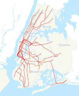

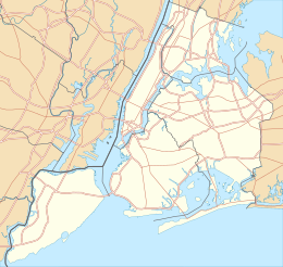
金斯公路車站(英语:Kings Highway)是紐約地鐵IND卡爾弗線的一個快車地鐵站,位於布魯克林格雷夫森德金斯公路及麥當奴大道交界,設有F線(任何時候停站)列車服務。
車站結構
@media all and (max-width:720px)body.skin-minerva .mw-parser-output .mw-stackfloat:none!important;width:100%!important.mw-parser-output .stack-containerbox-sizing:border-box.mw-parser-output .stack-clear-leftfloat:left;clear:left.mw-parser-output .stack-clear-rightfloat:right;clear:right.mw-parser-output .stack-leftfloat:left.mw-parser-output .stack-rightfloat:right.mw-parser-output .stack-objectmargin:1px;overflow:hidden
軌道配置圖 | |||||||||||||||||||||||||||||||||||||||||||||||||||||||||||||||||||||||||||||||||||||||||||||||||||||||||||||||||||||||||||||||||||||||||||||||||||||||||||||||||||||||||||||||||||||||||||||||||||||||||||
|---|---|---|---|---|---|---|---|---|---|---|---|---|---|---|---|---|---|---|---|---|---|---|---|---|---|---|---|---|---|---|---|---|---|---|---|---|---|---|---|---|---|---|---|---|---|---|---|---|---|---|---|---|---|---|---|---|---|---|---|---|---|---|---|---|---|---|---|---|---|---|---|---|---|---|---|---|---|---|---|---|---|---|---|---|---|---|---|---|---|---|---|---|---|---|---|---|---|---|---|---|---|---|---|---|---|---|---|---|---|---|---|---|---|---|---|---|---|---|---|---|---|---|---|---|---|---|---|---|---|---|---|---|---|---|---|---|---|---|---|---|---|---|---|---|---|---|---|---|---|---|---|---|---|---|---|---|---|---|---|---|---|---|---|---|---|---|---|---|---|---|---|---|---|---|---|---|---|---|---|---|---|---|---|---|---|---|---|---|---|---|---|---|---|---|---|---|---|---|---|---|---|---|---|
| |||||||||||||||||||||||||||||||||||||||||||||||||||||||||||||||||||||||||||||||||||||||||||||||||||||||||||||||||||||||||||||||||||||||||||||||||||||||||||||||||||||||||||||||||||||||||||||||||||||||||||


P 月台層 | 北行 | 無服務(P大道) |
島式月台,翻新至2018年初 | ||
尖峰特快 |  往牙買加-179街(18大道) 往牙買加-179街(18大道) | |
島式月台,左側開門 | ||
南行 |  往康尼島-斯提威爾大道(U大道) 往康尼島-斯提威爾大道(U大道) | |
M | 夾層 | 往出入口、車站詢問處、MetroCard自動售票機 |
G | 街道層 | 出入口 |
此站設有兩個島式月台和三條軌道[3]
往康尼島(南行)或曼哈頓及皇后區(北行)使用慢車軌道。中央軌道只有繁忙時段時使用[3]。
2016年6月7日至2017年5月1日,此站南行月台關閉以便進行翻新[4][5]。而曼哈頓方向月台則自2017年5月22日關閉至2018年初[6][7]。
參考資料
^ Station Developers' Information. Metropolitan Transportation Authority. [2017-06-13].
^ Facts and Figures: Annual Subway Ridership 2011–2016. Metropolitan Transportation Authority. 2017-05-31 [2017-06-01].
^ 3.03.1 Feasibility and Analysis of F Express Service in Brooklyn (PDF). Metropolitan Transportation Authority. May 2016 [June 24, 2016].
^ Feasibility and Analysis of F Express Service in Brooklyn (PDF). Metropolitan Transportation Authority. May 2016 [June 24, 2016].
^ Coney Island-bound F subway trains will not stop at Avenue I, Bay Pkwy, Avenue N, Avenue P, Avenue U, and Avenue X until early 2017. web.mta.info. Metropolitan Transportation Authority. 2016 [October 9, 2016]. (原始内容存档于May 27, 2016). 已忽略未知参数|df=(帮助)
^ New York City Subway Map (PDF). mta.info. Metropolitan Transportation Authority. May 1, 2017 [May 2, 2017]. (原始内容 (PDF)存档于May 10, 2017).
^ $140 Million Culver F subway Line Station Renewal Project Begins Next Phase. web.mta.info. Metropolitan Transportation Authority. May 18, 2017 [May 18, 2017].
外部連結

S大道西南樓梯
- nycsubway.org—BMT Culver Line: Kings Highway
- Station Reporter — F Train
- The Subway Nut — Kings Highway Pictures
- Kings Highway entrance from Google Maps Street View
- Avenue S entrance from Google Maps Street View
- Platforms from Google Maps Street View (During 2016-2018 Renovation)
| |||||||||||||||||||||
 紐約地鐵F線

